
Can We Fix Our Rivers?
From Alaska To Appalachia Find Out Which Waterways Made The List of Most Endangered Rivers & How You Can Help


Our country’s rivers and clean water supplies are in crisis. Half of the rivers in the U.S. have unsafe levels of pollution, threatening drinking water. HALF.
Each year, American Rivers, a national conservation organization working to make every river clean and healthy for people and wildlife, creates a list of America’s Most Endangered Rivers®.
This annual call to action highlights the biggest issues our rivers face and the solutions. By teaming up with local partners and generating national attention, they help mobilize the public to act and deliver results for rivers and all of the life they support.
“Rivers and clean water are essential to our nation’s health, safety, and prosperity,” writes Tom Kiernan, president and CEO of American Rivers, in the 2025 report. But pollution and extreme weather are putting rivers, people, and wildlife at risk.”
Now celebrating its 40th anniversary, the list has a track record of success: from preventing pollution in Arkansas’ Buffalo National River, to stopping a harmful diversion project on New Mexico’s Gila, to restoring Maine’s Penobscot and safeguarding special places like Wyoming’s Hoback River and Minnesota’s Boundary Waters, to rallying support for rivers nationwide. Read more success stories here.
Clean water is essential for health, and rivers provide the water our communities need. In fact, most of our water comes from rivers, and abundant river water is necessary for crops and cities alike.
This year, these 10 rivers need your attention and action.
#1 Mississippi River
Threats: Increased flooding, inadequate disaster prevention and response
The Mississippi is “America’s River,” flowing through the nation’s heartland, providing drinking water for 20 million people and supporting vital agriculture, industry, and recreation. Locals affectionately refer to it as the “Mighty Mississippi,” but it’s now in danger.
Frequent and severe floods are threatening lives and businesses, while the river’s health declines. Communities along the river need significant support for disaster prevention and response, as well as river restoration, but the fate of the Federal Emergency Management Agency (FEMA) hangs in the balance. The current administration needs to modernize FEMA to improve river health and maximize the safety, security, and prosperity of Mississippi River communities.
Action: The federal government must maintain a robust role in managing floods and other natural disasters since rivers know no borders. Core federal capabilities that must be maintained and improved include providing publicly available data related to flood risks, modernizing floodplain development standards to ensure investments are resilient to flooding, and improving granting efficiencies to help communities improve their resilience to floods faster. As extreme weather brings more flooding to river communities, a more effective and efficient FEMA is essential to helping communities prepare for, respond to, and recover from floods, while supporting a healthy and thriving Mississippi River.
Support these orgs: One Mississippi; Mississippi River Trust; Friends of the Mississippi River; Mississippi River Collaborative; Lower Mississippi Riverkeeper; Pearl Riverkeeper;
#2: Tijuana River / Rio Tijuana
Threats: Pollution, public health
Also on last year’s list, the Tijuana River is known for its communities on both sides of the U.S./Mexico border as well as stunning beaches, world-class surf breaks, and diverse wildlife. This region has been plagued with severe pollution for decades. Every day, millions of gallons of contaminated stormwater, sewage, harmful chemicals, and trash flow down the river into the Pacific Ocean. Local health authorities have issued closures to protect public health at the once world-class beaches. Major federal investments are needed to solve this growing environmental and public health crises.
Yesterday, EPA Administrator Lee Zeldin visited the Tijuana River and called for Mexico to take urgent steps to help stop the flow of untreated sewage on the border, saying that U.S. and Mexican officials plan to collaborate on a “100% solution” to halt the flow of raw sewage in the river.
Action: Community activists and local leaders have formed a coalition by uniting more than 50 local organizations, policymakers, and government agencies to build awareness of pollution-related public health threats and advocate for solutions at all levels of government.
The coalition’s advocacy efforts have helped to secure hundreds of millions of dollars in funding to implement the Comprehensive Infrastructure Solution (CIS), vetted by the federal government, impacted communities, and local governments, but Congress needs to authorize millions more to finish the project, ensure longterm maintenance, and to fund a much needed river diversion project, which would prevent harmful pollution from flowing in the main river channel near residential neighborhoods and schools.
A federal emergency declaration by the Trump administration would prioritize funding needs and would provide immediate relief to frontline communities, such as air filters, baseline health studies, pollution monitoring, and regional public advisories.
Support these orgs: Surfrider Foundation; WildCoast; San Diego Coastkeeper; Emerald Keepers
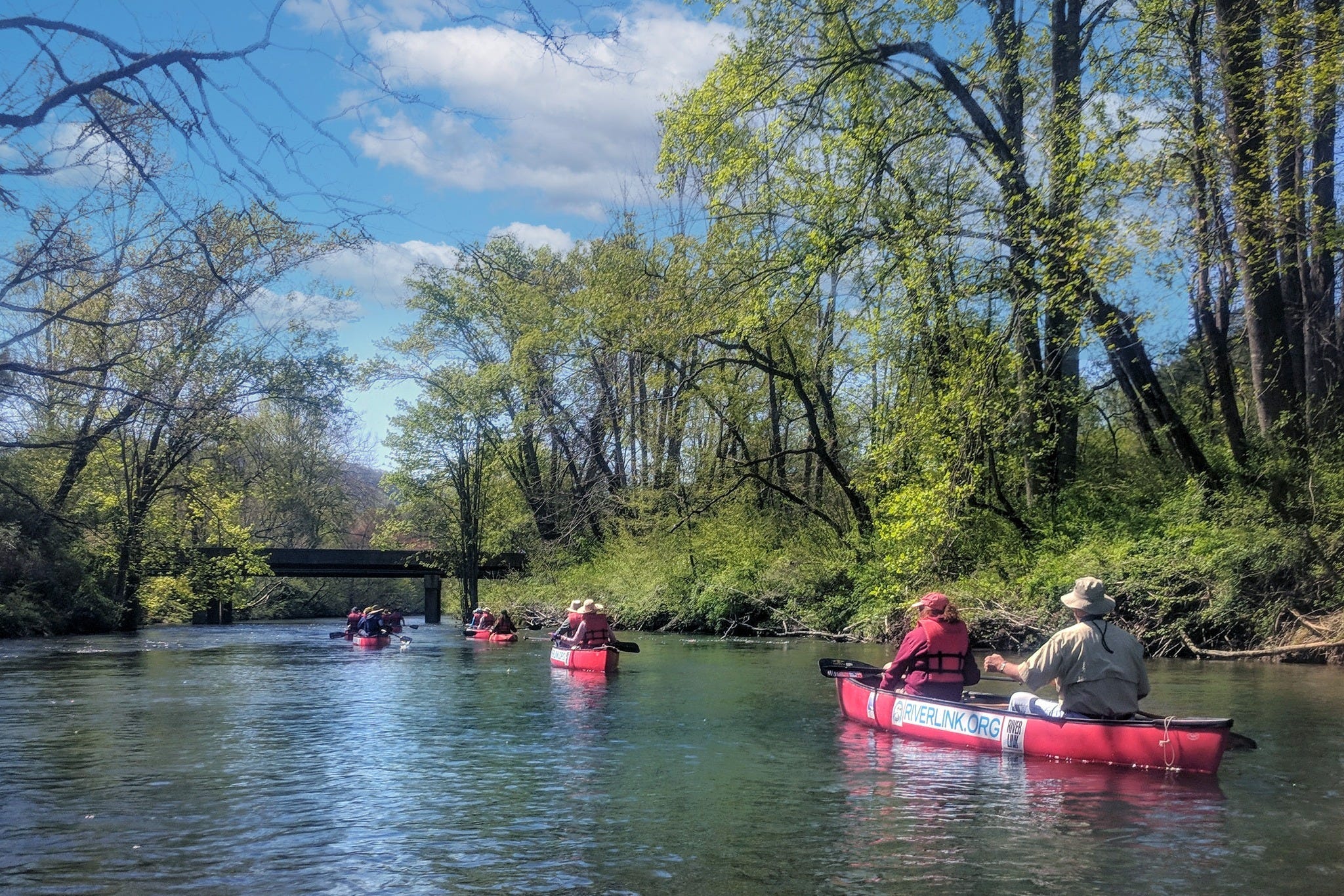
#3: Rivers of Southern Appalachia
Threats: Extreme weather, flooding, unsafe dams, lack of federal capacity
Southern Appalachia’s rivers span the eastern continental divide, providing clean drinking water to more than 2 million people throughout dozens of communities from Newport, Tennessee, to Charlotte, North Carolina. These rivers are the economic, recreational, and environmental drivers of the region and are vital to the local and regional economy. The French Broad River watershed alone contributes more than $3.8 billion annually to the region, largely from tourism and recreation.
In September 2024, Hurricane Helene devastated communities in the French Broad watershed (including the French Broad, North and South Toe, Cane, Nolichucky, Swannanoa, and Pigeon Rivers), Broad River (including Green and Pacolet Rivers), Watauga River (including the Elk River), New River, Catawba River, and many other rivers, creeks, and waterways. The record rainfall and the largest flood in the region’s history claimed 104 lives, destroyed drinking water and wastewater infrastructure, sent debris and pollution into waterways, reshaped river valleys in a landscape-scale event, breached dams, and obliterated sensitive fish and wildlife habitat.
Federal, state, and local partners have already allocated resources to the region, but there is a long road to recovery and preparation for the next storm in the years to come.
Action: Mountain communities must not be forgotten and should have the capacity to address these impacts. Recovery efforts will require robust funding and staffing to ensure the region’s economic recovery, to keep communities safe during the next storm, and to bring back the health of the Rivers of Southern Appalachia.
Regional nonprofits and local governments are poised to act as funding becomes available. Federal natural resource agencies should prioritize the restoration and protection of the region’s rivers so that they are resilient to future storms. Funding must be released to implement projects on the ground including debris cleanup, floodplain buyouts, infrastructure improvements, streambank stabilization, dam removals, floodplain protections, and stormwater mitigation.
Congress must provide oversight of the federal agencies to ensure that there is adequate staffing to effectively implement the work as directed and funded by Congress including ensuring the FEMA, U.S. Forest Service, and regulatory agencies have boots on the ground needed to respond to the needs of communities.
Support these orgs: Riverlink; Mountain True; Appalachian Voices
#4: Passaic River
Threat: Industrial Pollution
From its headwaters in Morris County, New Jersey, the Passaic River flows approximately 80 miles through a landscape of contrasts. It has always been a vital resource, supporting livelihoods and economic growth, but it has also been badly contaminated by the chemical manufacturing industry.
The Lower Passaic River was designated as a Superfund site in 1984, owing to nearly two centuries of pollution by heavy industry and manufacturing along the river. From America’s earliest textile mills, to the chemical manufacturers of DDT and Agent Orange to name a few, companies have used the river for waste disposal and economic gain. This has resulted in an accumulation of toxic waste that includes heavy metals.
Action: To restore this river to its full potential, contamination must be fully remediated as quickly and efficiently as possible. That will involve addressing dioxins, PCBs, sewage, and other contaminants in the full length of the Lower Passaic River.
The EPA’s Agency’s Region 2 Office must maintain its commitment to the people of New Jersey and ensure that the cleanup continues to be a top priority. This means continued support of the experienced federal staff working to advance the cleanup, as well as maintaining proactive oversight of the Superfund legal process to ensure participation by all responsible parties.
Support these orgs: Ironbound Community Corporation; NY/NJ Baykeeper; Trust for Public Land; Great Swamp Watershed Association; Passaic River Community Advisory Group
Upcoming: May 6, 2025 Virtual Community Meeting
EPA Region 2 is hosting a virtual community meeting to discuss the status of the cleanup of the Diamond Alkali Superfund site. Specifically, the meeting will be about the upper 9 miles of the Passaic River, which stretches from Clifton and Garfield to Newark and Kearny, New Jersey.
Date: Tuesday, May 6, 2025
Time: 6:00 p.m. to 8:00 p.m.
Location: Zoom
#5: Lower Rio Grande
Threats: Water scarcity, overallocation, aging infrastructure, harmful border policies
The Rio Grande is an icon of the west, lifeblood of the American Southwest, and the third longest river in the country, providing water and life to 6-million-plus people. The river is a vital economic, cultural, and ecological resource, but despite its immense value to people and nature, the river has been under constant threat for decades.
Today, the Lower Rio Grande basin and nearby communities are dealing with water scarcity, pollution, and overallocation. Prolonged drought, intensifying heat, and unsustainable water use has left the Rio Grande in a near-permanent human-induced megadrought, threatening all life that depends on it. The recent Minute 331 agreement established a Binational Environmental Working Group, creating a critical opportunity to advance conservation efforts and advocate for much-needed federal funding to ensure the river can continue to support people and nature.
Action: Mexico, the U.S., and water users must build on their collaborative efforts and continue working together to fund and implement key provisions of Minute 331. By doing so, they can help sustain the Rio Grande’s flow, ensuring water security for people, farms, and the environment. A thriving river supports thriving communities, and protecting the Rio Grande means securing clean, reliable drinking water for millions and restoring its natural hydrological functions. Federal policymakers need to prioritize dedicated funding for the Rio Grande, as their support is critical in securing federal appropriations.
Support these orgs: Rio Grande International Study Center; The Colorado Rio Grande Restoration Foundation; The Rio Grande Headwaters Restoration Project
#6: Rappahannock River
Threats: Water mismanagement, lack of planning
The Rappahannock River is one of Virginia’s most iconic waterways, stretching over 195 miles from the Blue Ridge Mountains to the Chesapeake Bay. It’s a primary source of the growing region’s water supply, but the river is at risk from a lack of water supply planning that would safeguard and ensure the future of the region’s precious water resources for all beneficial users.
The increasing strain on water resources, and the absence of unified water management, threaten the river’s ability to meet the needs of both people and nature. Increasing demand for surface water, driven by population growth, expanding industries like data centers, and declining groundwater levels, pose a significant threat to the river’s health and sustainability. Virginia is already the largest data center market in the world. New state regulations require regional water supply plans, but a coordinated basin-wide approach is crucial to safeguard the Rappahannock.
Action: Despite new regulations requiring regional water supply plans, the five planning regions within the Rappahannock watershed are not required to work together. And new water intake permits, issued without robust scientific analysis, could open the door to large inter-basin water transfers with long-term consequences. The Virginia Department of Environmental Quality and Department of Health and other state agencies need to coordinate and develop a comprehensive basin-wide water supply plan. In addition, water withdrawn from the river must be returned to the river basin and not transferred to others to promote sustainable use of the water supply.
Support these orgs: Friends of the Rappahannock; Rappahannock River Roundtable
#7: Clearwater River Basin
Threats: Commercial logging, dredge mining, dam-building
The stunning Clearwater River Basin in the Nez Perce-Clearwater National Forest is known as a “Noah’s Ark” for Chinook salmon, steelhead, westslope cutthroat trout, and bull trout. Its cold, clean, high-elevation streams can sustain fish populations even as temperatures warm. The clean water that filters through the old growth forests and fills 700 miles of streams is one of the most valuable resources, but those waterways are at risk from commercial logging, mining, and future dams.
A new land management plan that relaxes restrictions on mining and dam-building while expanding commercial logging could destroy habitat, trigger erosion, and pollute these exceptional streams. The Nez Perce-Clearwater National Forest must strike a better balance to ensure that timber harvest and other activities don’t degrade clean water and other values.
“These rivers are a national treasure that belong to all Americans. It’s painfully obvious to those of us that float these incredible rivers that it doesn’t make sense to roll back their protections just to make logging easier,” notes Kevin Colburn, national stewardship director for American Whitewater. “This is not a place to cut corners. The Forest Service should ensure these amazing rivers continue to thrive while managing timber and other resources. They’ve abandoned this reasonable approach.”
Action: The Nez Perce-Clearwater National Forest must provide new direction on how to conduct commercial logging, dredge mining, and other extractive activities while protecting clean water and healthy fish, and wildlife habitat. First, the Forest must revise its outdated Comprehensive River Management Plan for the Wild and Scenic designated Lochsa, Selway, and Middle Fork Clearwater Rivers to provide guidance on how to design projects to ensure protection of the values for which these rivers have been protected since 1968. Those values include scenery, recreation, and old-growth forests whose cold, clear waters are home to Chinook salmon, steelhead, bull trout, and westslope cutthroat trout.
Second, for the 700 miles of rivers that it is no longer “Wild and Scenic eligible” under its new land management plan, the Nez Perce-Clearwater National Forest must issue a forest plan amendment to provide project-level guidance that formally documents how other plan components will protect these rivers from the harmful effects of unsustainable logging, dam-building, and dredge mining.
Support these orgs: Idaho Rivers United; American Whitewater
#8: Sustina River
Threats: Road construction, mining, pollution
South-central Alaska’s Susitna River is one of the most pristine rivers in the United States and supports the fastest growing population in the state of Alaska. Home to an abundance of fish and wildlife, the river plays an important role for Alaska Native communities and also powers a strong economy dependent on the renewable resources of fishing and hunting.
The construction of an industrial access road to allow for mining and oil and gas development threatens the area’s natural wealth and all who benefit from a healthy river.
Action: The U.S. Army Corps of Engineers (USACE) is expected to review permit applications for the West Susitna Industrial Access Road in the coming year. American Rivers will join partners to call for USACE to deny all 404 permits and reject federal funding for this project so road construction does not move forward.
By engaging early and often in the upcoming permit review process, the public can join these efforts and significantly influence whether or not USACE decides to greenlight the proposed access road. It will be crucial for public comments to emphasize essential clean water, Tribal consultation, cultural resources, fish migration, and the uniquely intact nature of this treasured region.
Support these orgs: Sustina River Coalition; Cook InletKeeper; Trout Unlimited
#9 Calcasieu River
Threat: Pollution
For centuries, the Calcasieu River has been the lifeblood of southwestern Louisiana, sustaining local communities, abundant wildlife, and thriving ecosystems. It is home to Pinky, the beloved pink dolphin, and is a place of deep connection for generations of people.
A history of chemical mismanagement and continued unregulated dumping of toxic chemicals poses an existential threat to the river’s future. The river has suffered multiple catastrophic pollution events in recent decades. In 1994, more than 1.7 million pounds of ethylene dichloride spilled into the west bank of the Calcasieu. In 2006, a refinery spilled millions of gallons of oil into the river, impacting an estimated 150 miles of shoreline. The results of these and other disasters have been massive fish kills, poisoned air, forced evacuations, and countless sickened residents in historic Black communities like in Mossville, Louisiana.
Action: The EPA is working on its two-year review, set to be complete by late 2025 or early 2026. The agency needs to update the water pollution standards and develop water pollution standards for “petcoke calciners,” which have escaped federal regulation for more than 50 years.
Support these orgs: For A Better Bayou; Habitat Recovery Project
#10: Gauley River
Threat: Pollution from coal mining
Few places in West Virginia rival the scenic splendor of the Gauley River’s headwaters. The river is a world-famous whitewater destination, beloved by kayakers and rafters from around the globe.
Yet, this same remarkable watershed faces a grave threat: toxic pollution from coal strip mining in the headwaters of the Cherry River, one of the Gauley’s primary tributaries. In Greenbrier and Pocahontas counties in West Virginia, South Fork Coal Company operates a network of strip mines, haul roads, and a coal preparation plant spanning across 3,600 acres. These mines have violated water pollution standards at least 80 documented times since 2019, releasing sediment and toxic heavy metals, at times exceeding legal limits by more than 900 percent, into the river.
The company filed for Chapter 11 bankruptcy in February 2025, but this does not relieve this company from the restrictions of law, nor does it absolve regulators of their enforcement responsibilities.
Action: Whether you are a West Virginian, a public lands advocate, or simply a concerned individual, you can take action by telling the Office of Surface Mining Reclamation and Enforcement to reject South Fork Coal Company’s attempt to legitimize, after the fact, its ongoing operations within the Monongahela National Forest. By sending your comment, you can underscore the illegal use of our national forest lands and the mounting water pollution in the Gauley River watershed.
Support these orgs: West Virginia Highlands Conservancy; Allegheny-Blue Ridge Alliance
Dig into the full report here.